It is explained for the motion of the two vortices in close proximity. When two vortices moved close to each other, they are going to rotate "counterclockwise" to each other.
(http://en.wikipedia.org/wiki/File:Fujiwhara_Diagram.jpg)

Basically two vorticies are driven by each other's flow on the other side of the area of effected wind flow.
(taiwanpedia.culture.tw/images/media/earth/G012.jpg)

In May 1st, 1995. B. Ziv and P Alpert from Department of Geophysics and Planetary Science in Tel Aviv University in Israel explained how Fujiwara Effect is still in action in mid latitude as well.
(http://journals.ametsoc.org/doi/abs/10.1175/1520-0469%281995%29052%3C1357%3AROBCDA%3E2.0.CO%3B2)
This effect is widely observable on two Tropical Storms are in close proximity of each other.
The clip below will show clearly of this effect on Tropical Storms.
The video below showed how Fujiwara Effect on 2 sets of mid latitude storms are interacting to each other.
(http://commons.wikimedia.org/w/index.php?title=File%3ASevere_Tornado_Outbreak_in_the_Southern_United_States.ogv)
For mid latitude storms in average, the vicinity of 2000km of each other (really depended on each other's wind field and strength) will start to feel the effect. To have more significant acceleration, they must get closer to 1000km to each other. But to pinpoint the movement of multiple vortices in mid latitude is depended on the size of the two vortices, the distance to each other and the prevailing atmospheric wind direction at that period of time. The effect is also more predominant when the vortices is in the same side of the jet stream.
Today over West Coast, we have noticed the slow down of the vortices over Southern BC. As you see the 500mb wind field around the southern vortice over Eastern Pacific and BC vortices (maybe a little bit Nevada vortice, but it is further away) started to interacting to each other.
(From NECP NOAA)
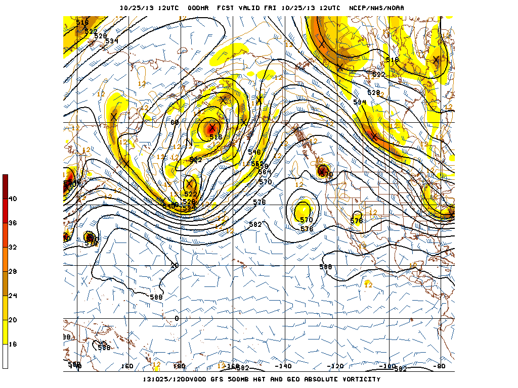

From satellite loop (too big to post, might need to shrink the loops later) shows that 3 major vortices in place. One over Nevada, one over Eastern Pacific and the other one over Southern BC. New wave of low from Yukon to Prairies has pushed the BC vortice a little south and getting closer proximity toward the upper low over Eastern Pacific. This low has been forecasted by all the models from the past few days in slower eastward and even a tad westward trend. GEM is having trouble to pinpoint the exact location of the low is going to be.

Due to this upper low lingered in speed has slowed, the wind field near the surface and longer duration of the subsidence from south west quadrant of the low centre made fog dissipation for Strait of Juan da Fuca a little faster on visible satellite.

This is a very subtle Fujiwara Effect, but definitely played a role with our weather systems :)
No comments:
Post a Comment